Saturday, March 7th 2026
A major stratospheric warming is taking place in the atmosphere, a rare disturbance that could overturn the winds high above the Arctic and “split” the polar vortex.
The first effects are already visible in forecasts, and weather models show that the impact could gradually descend into the lower atmosphere during the second half of March, writes Severe Weather Europe.
The polar vortex is a wide area of air. cold and strong winds that circulate around the Arctic in winter. When it is stable, the cold air generally remains “locked in” to the north, and Europe often has calmer and milder periods.
When it weakens or separates, that barrier loosens and the probability of larger weather fluctuations in the mid-latitudes, including Europe, increases.
However, such a disruption does not mean that the entire continent will automatically enter a cold wave. In practice, it often happens that the arrangement of high and low pressure reverses, so that one part of Europe ends up in a warmer and more stable regime, while the rest gets cooler air and more variable conditions.
Stratospheric warming occurs high above the layer where clouds and precipitation form, but it can “start a chain reaction”. In such situations, temperatures in the stratosphere rise significantly, and winds may even change, which is a sign that the polar vortex has been seriously disturbed.
The effect is usually not immediately felt on the ground, but, if it “comes down” at all, it usually spreads to the lower layers over a period of 10 to 30 days. This time, forecasts indicate that a more pronounced pattern could develop during March, bringing stronger contrasts between certain parts of Europe.
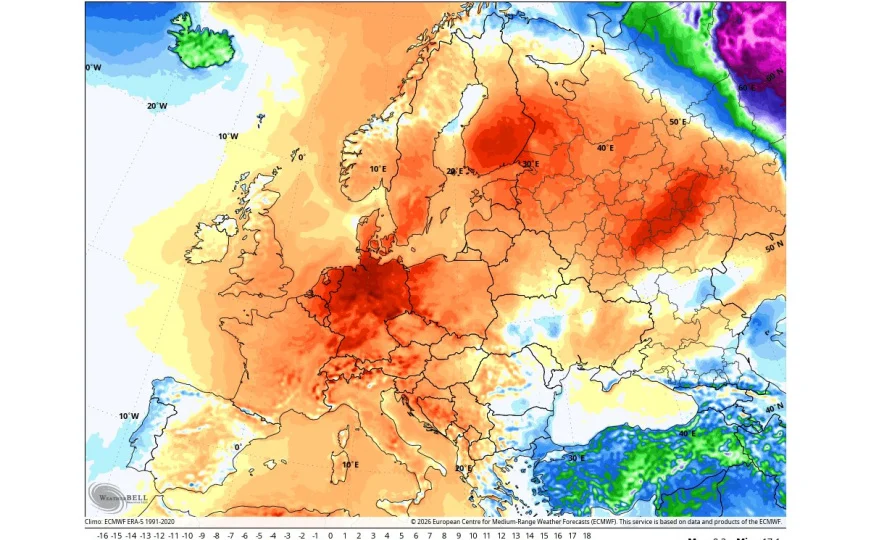
Short-term forecasts show a strengthening of the high pressure area over Europe, which usually brings more stable weather and above-average temperatures to parts of the continent. At the same time, the possibility remains that marginal areas under the influence of lower pressure will remain more variable, with the occasional intervention of cooler air.
As mid-March approaches, part of the model suggests a strengthening of the westerly flow from the Atlantic. Such a schedule usually brings more moisture, more cloud and more frequent precipitation, especially in western and central parts of Europe, with alternating warmer and cooler episodes. In this combination, spring can look “unsettled”, with sudden changes from day to day.
Forecasts for the second part of March continue to highlight a split pattern in which pressure systems set up to bring warmer air to one part of Europe and a cooler, more unstable regime to another.
In such situations, the northern and northeastern parts of the continent more easily stay in the warmer mass of air, while central and southern Europe more often feel the penetration of cooler air and more variable conditions.
We use cookies to improve the experience and display ads (Google AdSense).
By clicking “Accept”, you agree to the use of cookies according to
Privacy Policy
and
Cookies Policy.
You can reject non-necessary cookies by clicking “Reject”.
Source: prizrenpost